
Exhibitors' information
Asia Air Survey co., ltd.
![]()

Red Relief Image Map
Twenty years have passed since its invention, and while the initial patents have expired, the improvement patents developed in the meantime are still valid. Here, we introduce the latest information on the "Red Relief Image Map" used in various forms.

Projection MappingTwenty years have passed since its invention, and while the initial patents have expired, the improvement patents developed in the meantime are still valid. Here, we introduce the latest information on the "Red Relief Image Map" used in various forms.
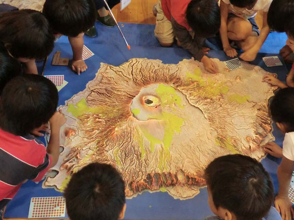
In collaboration with Weathercock Co., Ltd. in Sapporo, we have developed precise projection mapping on red relief image maps. Using a 1:10,000 scale model of Mount Usu, we will conduct demonstrations with geological maps, hydrological maps, and video projections.
Cool Map
Maps should be laid on the floor. COOLMAP overlays black slope maps from DSM with color-coded building heights, topped with red relief image maps. Viewing this map gives you the sensation of flying in the sky. Patents have been obtained both domestically and internationally.

Analog Model Experiments
In geoscience, where full-scale experiments are difficult, analog model experiments are often conducted. This time, we will conduct our usual shampoo lava experiment and urethane eruption experiment on red relief image map models.
VR Experience
Let's view the 3D measurement results in 3D. You can experience a demonstration using a head-mounted display currently under development.
-
Department
Advanced Technologies Research Laboratory
-
Address
215-0004
1-2-2,manpukuji,asao-ku,kawasaki-city,kanagawa pref.Japan -
Web site, SNS